
Maximum building heights of 9m and 11m apply for neighbourhood residential zone and general residential zone, respectively.
Dimensioning
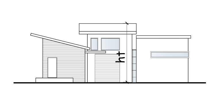
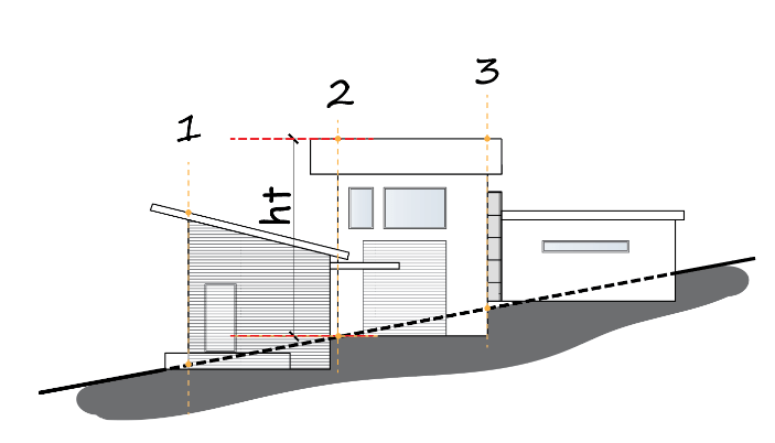
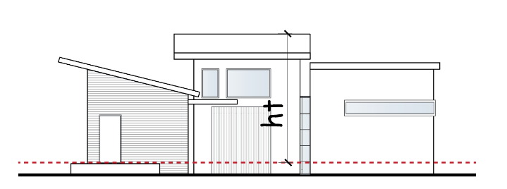
The height is dimensioned from the highest point vertically down to the point of intersection at natural ground level ground level
There are three dimension lines which are all correct however dimension line 2 is the most critical because it is the largest; this is the dimension required to be below the maximum height specified. Let’s say dimension line ‘1’ was the largest of the three; it would be the most critical even though its positioned lower than 2 and 3. (A4 diagram2)
Higher Due to Slope
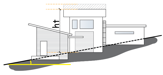
An additional 1m of height is allowed if the slope of the natural ground exceeds 2.5° over a cross section of at least 8m. This example is clearly in excess of 2.5° over any 8m section of land where the building will be sited. In reference to this diagram, excludes green shaded area Diagram 3
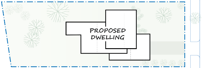
The green dashed line applies because it’s within the building area; the red does not apply because it extends beyond the building outline. The red/green line applies if the green portion is at least 8m long within the building outline.
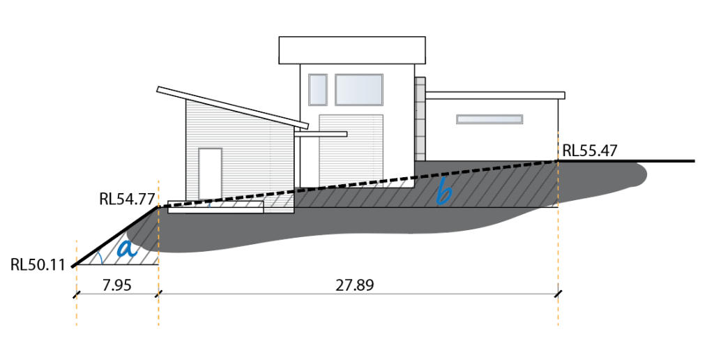
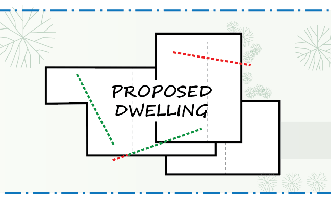
Diagram 4
This example has two triangles, a and b:
Triangle A
[θ=] [ [tan] ^(-1) ] ( Opposite/Adjacent )
[θ=] [ [tan] ^(-1) ] ( (54.77-50.11)/7.95 )
θ=30.38°, over 2.5° however over a distance of less than 8m. Even if this cross-section was over 8m it is not within the area where the proposed dwelling will be sited
Triangle B
[θ=] [ [tan] ^(-1) ] ( Opposite/Adjacent )
[θ=] [ [tan] ^(-1) ] ( (55.47-54.77)/7.95 )
θ=1.44°, Over a distance greater than 8m however under 2.5°
Higher Due to Site Being Subject to Inundation
Residential zones specify the height is the vertical distance from the minimum floor level determined by the relevant authority ie Melbourne Water, if the land is in a Special Building Overlay and/or Land Subject to Inundation Overlay.